-
Elena's Story
Nancy Shaw, Kristina Rodanas
Hardcover (Sleeping Bear Press, Aug. 1, 2012)Elena lives near a small town in western Guatemala. She lives there with her mother, her younger brother, Luis, and her baby sister, Ana. Her father is far away, working on a plantation. Elena struggles to keep up in school. Her teacher says she needs to practice her reading, but it's hard to find time to read. She must help her mother with the cooking and housework, as well as the hard work of planting and weeding their garden. As the big sister Elena is also in charge of watching over Luis to keep him out of mischief. It isn't always easy and she gets impatient with her little brother. But at the end of the day, when Elena shares a book with Luis, carefully sounding out the words, she comes to better understand and appreciate her role in the family. L
L
-
Atlas of the World
Oxford
Hardcover (Oxford University Press, Oct. 15, 2008)Oxford's Atlas of the World is the most authoritative resource on the market. The Fifteenth Edition remains the finest international reference source of its kind available. Including a free world wall map in every volume, updated census information, dozens of city maps, a gazetteer of nations, gorgeous satellite images of Earth, and a geographical glossary, this atlas offers exceptional value at a reasonable price. Full of crisp, clear cartography of urban areas and virtually uninhabited landscapes around the globe, the Atlas has maps of 69 cities and nearly 100 different regions at carefully selected scales to give a striking view of the Earth's surface. Opening with world statistics and then a colorful, instructive 48-page Introduction to World Geography--beautifully illustrated with tables and graphs--this acclaimed resource provides details on such topics as climate, the greenhouse effect, plate tectonics, agriculture, population and migration, and global conflicts. As in years past, this edition includes the latest geographic information: a new flag for Iraq, the addition of the Republic of Kosovo to the map of Europe, a new region in Senegal and two provinces in the Philippines, plus the appearance of the world's newest landmass, Warming Island, revealed by the melting Greenland ice sheet. Current census statistics also help to illustrate tables showing the population of world countries and cities and the popular satellite image section has been refreshed with stunning new images of different regions and urban areas. Providing the finest global coverage available, the Atlas of the World is not only the best-selling volume of its size and price, but also the benchmark by which all other atlases are measured. *Promotional world wall map included with every copy *Interior pages designed for heightened accuracy and ease of use *Detailed city plans and country profiles make it the ultimate geographic reference "An indispensable reference." --The Today Show "A veritable encyclopedia of geographic and demographic information, profusely illustrated. Extraordinary." --The New York Times "This authoritative volume is the standard by which others will be measured." --Boston Herald "You can't do better than the Atlas of the World." --Chicago Tribune
-
Waiting for the Owl's Call
Gloria Whelan, Pascal Milelli
Hardcover (Sleeping Bear Press, Sept. 14, 2009)Eight-year-old Zulviya, her sister and her cousin, her mother and her grandmother... they all belong to the loom. For generations the women of Zulviya's family have earned their living by weaving rugs by hand. The rugs are valuable and the women are proud of their beautiful handiwork. But the work is hard. It takes months to weave a rug; each one contains hundreds of thousands of knots. Before one work day has passed, Zulviya will tie thousands of knots. As she sits at her work, Zulviya weaves not one but two patterns. The pattern on the loom will become a fine rug. She weaves a second pattern in her mind. There she sees the green of the Afghani hills, the bright blue of the nearby lake, and the vivid orange of the setting sun. And Zulviya takes comfort in the landscape in her mind. Gloria Whelan's other picture books in the Tales of the World series are Yuki and the One Thousand Carriers (2008 Society of Illustrators Gold Medal winner) and Yatandou (a Junior Library Guild selection). Ms. Whelan lives in Michigan. Pascal Milelli's illustration clients include Harper's, The Atlantic, and Scribner Books. His picture book, The Art Room, by Susan Vande Griek, received the Amelia Frances Howard-Gibbon Illustrator's Award from the Canadian Library Association in 2003. Pascal lives in Vancouver, Canada. N
N
-
Atlas of South America and Antarctica
Malcolm Waxman, Malcolm Porter, Keith Lye
Library Binding (Rosen Pub Group, Jan. 1, 2010)Fascinate readers with this atlas that goes well beyond presenting maps and charts. Students learn about the history, industries, cultures, and peoples of South America and Antarctica. Photographs and illustrations provide support to the fast facts and insightful narrative about these spectacular continents. S
S
-
Atlas of Europe
S. Joshua Comire, Malcolm Porter, Keith Lye
Paperback (Rosen Central, Jan. 15, 2010)Presents the locations, topographies, climates, populations, industries, languages, religions, governments, economies, ecology, and wildlife of European regions and countries. Y
Y
-
Atlas of Europe
S Joshua Comire, Malcolm Porter, Keith Lye
Library Binding (Rosen Pub Group, Jan. 1, 2010)The many nations that make up the European continent are home to a stunning variety of people and cultures. The borders of todays Europe are the result of centuries of conflict and compromises. Now largely bound together in an alliance by the European Union, the countries of Europe are presented here as full-color maps. This atlas is a valuable, engaging resource for students. R
R
-
Atlas of Australia and the Pacific
S Joshua Comire, Malcolm Porter, Keith Lye
Library Binding (Rosen Pub Group, Jan. 1, 2010)The island continent of Australia, the nation of New Zealand, and the Pacific islands are home to some of the most unique terrain in the world. Maps, charts, and illustrations make it easy for readers to learn about these countries, from the people who inhabit them to natural features and climate. These atlases will take readers on a unique tour of this fascinating region of the globe. S
S
-
The Gift Of The Inuksuk
Michael Ulmer, Melanie Rose
Hardcover (Sleeping Bear Press, Oct. 30, 2004)Unique and as beautiful as a snowflake or footprint, an Inuksut (inNUKshuk,) is one of the stone figures that can be seen dotting the Canadian Arctic region. Many made by ancient hands, the Inuksuit (inNUKsweet) purposes are varied, from earthly uses such as navigation and message centers to those of the spirit, as sites of reverence. Author Mike Ulmer explores the connectedness of all Arctic life in his tale, The Gift of the Inuksuk.To find recipes, games, interactives maps and much more for this title visit www.discovertheworldbooks.com! Author Mike Ulmer keeps an Inuksuk at home--it reminds him of the way the Inuit People of the North live a simple life and consume only what they need. His tale expresses this belief in a warm and simple manner that readers of all ages will appreciate and enjoy. Artist Melanie Rose's charming and lively oil paintings bring great variety and surprising bursts of color to this unique northern story.Mike lives in Hamilton, Ontario, Canada with his wife Agnes Bongers and their three daughters: Sadie, Hannah and Madalyn. When he is not learning about Inuksuk, Mike writes a sports column for the Toronto Sun newspaper. Among Mike's books are M is for Maple: A Canadian Alphabet and H is For Horse: An Equestrian Alphabet. Melanie Rose lives in Mississauga, Canada with her son Liam, and their two cats, Mickey and Meesha. Melanie teamed up with Mike previously on M is for Maple: A Canadian Alphabet. She has also illustrated Z is for Zamboni: A Hockey Alphabet and K is for Kick: A Soccer Alphabet. She is a graduate of the Ontario College of Art.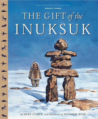 M
M
-
Atlas of the World
(by title)
Hardcover (Oxford University Press, USA, Nov. 20, 2003)Ten years ago, the first edition of Oxford's Atlas of the World was met with praise for the incredible beauty and accuracy of its maps as well as for its wealth of geographic data, and it only collects more accolades with each edition. The New York Times Book Review called it a "veritable encyclopedia of geographic and demographic information, profusely illustrated with multicolored maps and graphs," and Library Journal exclaimed that the newest edition was "a splendid achievement in geographical reference." The additions and improvements continue with an 11th Edition that boasts several new features. A Glossary of Geographical Terms will be an enormous asset to those unfamiliar with geographical jargon, and still more of the latest statistics will be collected in the colorful Introduction to World Geography section-providing abundant information on global issues such as climate, the greenhouse effect, plate tectonics, agriculture, population and migration, and global conflicts. Reflecting our turbulent and ever-changing planet, the 11th Edition will also highlight several key Regions in the News, keeping the atlas in step with current events. National Parks and Game Reserves have been added worldwide, and the overall precision and clarity of the entire book has been enhanced with redesigned map spreads. Laden with outstanding cartography, a revised Gazetteer of Countries, and nearly 70 sharp maps of the major cities on each continent, the Atlas also bears the distinction of being the only one of its kind that is updated annually to reflect the changing world around us. The recent dissolution of Yugoslavia, changes to provinces in Indonesia, refined name forms in Africa, alterations to administrative areas in Russia and Ethiopia, and dozens of other upgrades make this the most reliable atlas on the market. Providing the finest global coverage available, the Atlas of the World sets the standard for international atlases, living up to its reputation as an "indispensable reference," granted by NBC's Weekend Today Show.
-
Atlas of North America
Tina Lundgren, Malcolm Porter, Keith Lye
Library Binding (Rosen Central, Jan. 1, 2010)This illustrated atlas of North America combines maps, pictures, flags, globes, information panels, diagrams, and charts to give a complete overview of the region. W
W
-
Atlas of North America
Tina Lundgren, Malcolm Porter, Keith Lye
Paperback (Rosen Central, Jan. 15, 2010)Presents the locations, topographies, climates, populations, industries, languages, religions, governments, economies, ecology, and wildlife of North and Central American and Caribbean regions and countries. Y
Y
